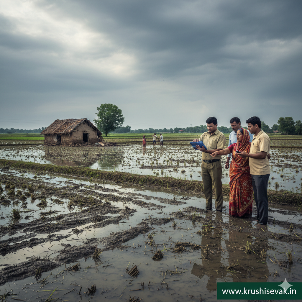

Introduction
Agricultural operations in Maharashtra are deeply connected to the seasonal cycles of the monsoon. While timely rainfall drives crop production across the state’s vast agricultural belts, the recent increase in extreme weather events—such as localized cloudbursts, severe prolonged downpours, and devastating hailstorms—presents an ongoing threat to rural livelihoods. Standing crops, critical soil infrastructure, and local irrigation systems can be destroyed within hours by heavy rainfall, exposing farming families to sudden and severe financial stress.
To insulate the agricultural community from the financial shock of natural disasters, the Revenue and Forest Department, alongside the Department of Agriculture of the Government of Maharashtra, runs a robust disaster relief and crop damage compensation framework. Financed through the State Disaster Response Fund (SDRF) and supplemented by state budget allocations, this institutional mechanism ensures that affected farmers receive direct financial assistance when localized natural calamities push crop losses beyond acceptable thresholds.
To maintain transparency, accelerate payouts, and eliminate administrative delays, Maharashtra digitized the entire crop damage assessment and payout architecture. The system integrates ground-level mobile tracking apps with centralized portal infrastructures like MahaDBT and Aaple Sarkar. For farmers seeking to claim their rightful compensation after heavy rainfall, understanding the exact eligibility guidelines, mandatory documentation, field survey procedures, and online portal mechanics is essential to securing timely financial relief.
Eligibility Criteria for Heavy Rainfall Compensation
The government operates under precise, legally defined parameters to determine when weather-induced crop damage qualifies for official state compensation. Financial assistance is not distributed as an arbitrary handout; it relies on clear environmental and geographic data.
1. Verification of the Localized Natural Calamity
For a region to be officially declared as hit by an eligible weather calamity, local weather stations, revenue circles, or automatic rain gauges must record rainfall that crosses the government’s formal “heavy rainfall” threshold. Generally, this means a precipitation level exceeding 65 mm within a single 24-hour window inside a specific revenue circle. Alternatively, prolonged unseasonal downpours or severe hailstorms during critical harvesting phases that cause visible, localized damage can also trigger the activation of the compensation framework by state authorities.
2. The 33% Crop Loss Threshold
Compensation is structurally tied to the severity of the damage sustained by the crop. According to SDRF guidelines, financial assistance is unlocked only when the physical crop loss or yield destruction is assessed to be 33% or higher. Any damage falling below this 33% baseline is considered minor operational risk and does not qualify for state relief funds.
3. Maximum Landholding Limits for Compensation
The state caps the maximum area for which an individual farm family can claim disaster compensation. Currently, the compensation package covers a maximum of up to 2 hectares of damaged land per farmer. Even if a large-scale landowner suffers complete crop destruction across five or ten hectares, the state’s financial relief remains legally capped at the two-hectare maximum to prioritize the financial survival of small and marginal farmers.
4. Classification-Based Payout Rates
The financial compensation per hectare scales based on the agricultural classification of the land and the nature of the crop cultivated:
- Rainfed (Unirrigated) Land: Receives the standard baseline compensation rate per hectare, targeting traditional seasonal crops like jowar, bajra, and pulses.
- Assured Irrigated Land: Receives an elevated compensation rate per hectare due to the higher input capital invested in cash crops like sugarcane or cotton.
- Perennial / Horticultural Orchards: Receives the highest compensation tier per hectare to offset the massive long-term losses associated with destroyed fruit orchards, such as mango, grapes, pomegranate, and citrus plantations, which take years to rebuild.
Critical Ground-Level Protocol: The Joint E-Panchnama
Before an online application can be finalized or any funds transferred, the state must mathematically verify the damage through a strict, transparent field survey known as a Panchnama. In modern operations, this is executed as a digital e-Panchnama.
Initiating the Assessment Notice
Immediately following a heavy rainfall event, the state government directs local administrative machinery to initiate surveys. However, farmers should not wait passively if their fields are severely hit.
The affected farmer should immediately notify their local Talathi (Gram Revenue Officer), Krishi Sevak (Agricultural Assistant), or Gram Sevak (Village Council Secretary). Informing these officials ensures the farm is promptly included in the upcoming local survey schedules.
Execution of the Joint Survey
The survey is conducted directly on the damaged field by a joint committee consisting of the Talathi, the Krishi Sevak, and local village representatives. The team physically inspects the standing crop, assesses the visible impact of waterlogging, silt deposition, or lodging, and reaches a consensus on the estimated loss percentage.
The Digital e-Panchnama Application
Using the official government e-Panchnama Mobile Application, the visiting officer records the findings digitally on-site. The process involves:
- Entering the farmer’s unique identifier and matching it with the specific plot coordinates.
- Selecting the precise crop type and logging the agreed-upon damage percentage (which must be 33% or higher to qualify).
- Geotagging and Photographic Evidence: The officer uses the app to take live photographs of the damaged field. The application automatically embeds the exact GPS latitude and longitude coordinates and a digital timestamp into the photo file, preventing fraudulent or duplicate claims from unimpacted areas.
- Digital Signatures: The panchnama record is signed digitally by the inspecting officers and verified via a biometric confirmation or signature from the farmer and accompanying village witnesses.
Mandatory Documentation Checklist
To prevent system rejections on the digital portal and ensure clean authentication by the public finance system, farmers must organize several key personal and land records:
- 7/12 Extract (Saat Bara Utara): The official land title document issued by the Revenue Department, which must be updated to show the current owner’s name and confirm the exact survey number of the plot.
- 8-A Holding Certificate: A document detailing the total consolidated landholding of the farmer within that village, ensuring compliance with the maximum 2-hectare relief cap.
- Crop Registration Record (E-Pik Pahani): The farmer must have registered their current seasonal crop using Maharashtra’s mandatory e-Pik Pahani mobile app earlier in the season. If the online land records do not show a registered crop matching the damaged crop cited in the panchnama, the compensation application will face severe processing delays.
- Aadhaar Card: The primary identity document used to authenticate the biographical profile of the claimant.
- Aadhaar-Linked Bank Passbook: A clear copy of the bank account details, including the IFSC code. The account must be actively linked to the farmer’s Aadhaar number to allow for direct digital fund transfers.
- Self-Declaration Form: A formal declaration signed by the farmer confirming that they have not claimed duplicate compensation for the same plot through other parallel disaster schemes.
Step-by-Step Online Portal Application Procedure
Once the physical e-Panchnama is uploaded to the state servers by local officials, the online application and verification cycle moves through the integrated MahaDBT Farmer Portal or the designated regional relief administration links.
Step 1: Accessing the Portal and Authentication
The farmer or an authorized operator at a local Common Service Centre (CSC) logs into the MahaDBT / Aaple Sarkar Portal. New users must register using their Aadhaar number, generating a secure One-Time Password (OTP) sent to their Aadhaar-registered mobile phone. Once authenticated, the portal pulls verified demographic information directly from the central database.
Step 2: Completing the Agricultural Profile
The user navigates to the ‘Farmer Schemes’ section and completes their profile details. This requires inputting permanent residential details, contact numbers, and precise banking information. The system cross-checks the bank routing numbers against active Public Financial Management System (PFMS) protocols to verify the account is open and ready for transfers.
Step 3: Entering Land and Calamity Specifics
The applicant enters the specific land details corresponding to the damaged plot, including the Taluka, Village name, Survey Number, and Gat Number. The portal’s drop-down menu requires selecting the specific natural calamity event (e.g., Heavy Rainfall/Unseasonal Rain/Hailstorm) and entering the exact calendar date when the severe weather occurred.
Step 4: Syncing the Digital e-Panchnama and Documents
The online system allows the farmer to link their profile with the digital e-Panchnama file previously uploaded by the Talathi. The farmer uploads clean, scanned PDF or JPEG copies of their updated 7/12 extract, 8-A certificate, and bank passbook. The portal enforces a file size limit, typically requiring documents to be under 500 KB to ensure successful transmission.
Step 5: Application Submission and Tracking Reference
After carefully reviewing all entered fields to ensure absolute consistency across land records, the e-Pik Pahani log, and the panchnama data, the user clicks “Submit.” The portal generates a unique Application ID / Tracking Reference Number. The farmer receives an automated confirmation SMS on their registered mobile number, which serves as official proof of submission for all future inquiries.
The Verification and Fund Disbursement Pipeline
Submitting the online form triggers a highly structured, automated financial approval workflow designed to deliver funds directly to the affected farmer without manual bureaucratic interference.
1. Cross-Validation at the Tahsildar Level
The application travels digitally to the desk of the respective Tahsildar (Sub-District Revenue Officer). The Tahsildar’s office cross-references the online application details, checking the uploaded land records against the geotagged parameters contained within the e-Panchnama database. This ensures that the claimed field matches a verified damage site.
2. Compilation of the Beneficiary Master List
Once individual applications clear sub-district validation, the district administration compiles a consolidated Beneficiary Master List. This list specifies the precise approved compensation amount for each farmer based on land size and crop classification metrics. The list is uploaded securely to the state’s central financial portal.
3. Direct Benefit Transfer (DBT) Execution
The approved financial compensation package is disbursed exclusively via the Direct Benefit Transfer (DBT) system. The state treasury transfers the relief funds directly from the State Disaster Response Fund account into the verified, Aadhaar-linked bank account of the beneficiary. This completely removes physical cheques or middleman handlers from the process, ensuring that 100% of the allocated government compensation reaches the intended farmer’s account securely and efficiently.