
For centuries, agriculture has relied heavily on historical intuition, localized knowledge, and broad, uniform management practices. Farmers traditionally treated entire fields as single, homogenous units—applying uniform amounts of water, fertilizers, and pesticides regardless of internal soil variations or localized pest outbreaks. This approach often led to the wasteful overuse of chemical inputs, environmental degradation, and suboptimal crop yields.
Today, a profound paradigm shift is underway across the global agricultural landscape. Faced with a rapidly growing global population, shrinking arable land, unpredictable weather patterns due to climate change, and severe labor shortages, the agricultural sector is undergoing a rapid digital transformation. At the very center of this transformation is smart farming, an innovative management concept focused on providing the agricultural industry with the infrastructure to leverage advanced technologies.
Among these breakthrough technologies, Unmanned Aerial Vehicles (UAVs)—commonly referred to as drones—have emerged as a pivotal tool. Once confined to military surveillance and recreational photography, drones have been repurposed into sophisticated agricultural instruments. By integrating high-resolution imaging, specialized sensors, autonomous flight capabilities, and advanced data analytics, drone technology is writing a new chapter in smart farming. This technology transforms traditional farming into a highly precise, hyper-efficient, data-driven operation capable of maximizing crop yields while minimizing environmental impact.
The Concept of Precision Agriculture
To understand the impact of drones, one must first understand the concept of precision agriculture. This modern farming management style relies on measuring, observing, and responding to inter-field and intra-field variability in crops. The core philosophy is simple: provide the right input, at the right place, at the right time, and in the right quantity.
Drones serve as the primary eye-in-the-sky for precision agriculture. Unlike satellite imagery, which can be heavily obscured by cloud cover and often suffers from lower spatial resolution, drones operate beneath the clouds. They capture incredibly detailed, real-time data at a millimeter-per-pixel level. This allows farmers to shift from generalized field management to macro-managed, micro-targeted interventions. Instead of treating an entire 100-acre field for a pest infestation, a drone can help pinpoint the exact two-acre patch that requires treatment, saving time, money, and resources.
Key Technological Components of Agricultural Drones
An agricultural drone is not just a flying camera; it is a complex flying laboratory equipped with cutting-edge hardware and software. Several core components enable drones to perform highly complex agricultural tasks.
Advanced Sensor Payloads
The true power of an agricultural drone lies in its sensors. Standard RGB cameras capture visible light and are useful for basic visual inspections, mapping, and counting plants. However, the real breakthroughs come from specialized sensors:
- Multispectral and Hyperspectral Sensors: These sensors capture light wavelengths beyond the visible spectrum, specifically Near-Infrared (NIR) and Short-Wave Infrared (SWIR). Plants reflect light differently depending on their internal chlorophyll levels and water stress. By analyzing these invisible wavelengths, multispectral cameras detect crop stress, disease, or nutrient deficiencies days before they become visible to the human eye.
- Thermal Sensors: These sensors measure the surface temperature of vegetation and soil. Because transpiring plants are cooler than dry, stressed plants, thermal imaging reveals structural flaws in irrigation systems, localized drought stress, and soil compaction.
- LiDAR (Light Detection and Ranging): LiDAR sensors emit rapid laser pulses to map the topography of the land. This technology creates highly accurate 3D models of the terrain, helping farmers analyze slope, elevation, and potential water accumulation zones.
Autonomous Navigation and Flight Planning Software
Modern agricultural drones rely on advanced Global Navigation Satellite Systems (GNSS), integrating GPS, GLONASS, and Real-Time Kinematic (RTK) positioning. RTK technology provides centimeter-level flight accuracy, ensuring the drone follows highly precise flight paths without drifting. Farmers use automated flight planning applications to pre-program flight boundaries, altitude, speed, and camera overlap. The drone can take off, execute a perfect grid-pattern scan of a field, avoid obstacles autonomously using built-in radar, and return to its base station to land without manual pilot intervention.
Edge Computing and AI Data Analytics
The massive volumes of raw imagery collected during a drone flight are useless without rapid processing. Modern smart farming systems utilize artificial intelligence (AI) and machine learning algorithms on cloud platforms or edge-computing hardware. This software automatically stitches hundreds of individual aerial images into a singular, highly detailed mosaic map known as an orthomosaic. AI models then scan this map to count individual crops, measure canopy cover, classify weed species, and generate actionable prescription maps that can be fed directly into autonomous tractors and smart farm machinery.
Major Applications of Drones in Smart Farming
The versatility of UAV technology allows it to be utilized across almost every phase of the crop cultivation cycle—from initial soil preparation to post-harvest analysis.
1. Soil and Field Analysis
Before planting even begins, drones equipped with LiDAR and multispectral sensors can map a field to analyze its topography and health. They generate precise 3D maps that help farmers understand water runoff patterns, locate erosion-prone zones, and optimize drainage systems. Furthermore, thermal and multispectral scanning provides critical data regarding soil moisture distribution and organic matter content, enabling farmers to make data-driven adjustments to their initial tilling, fertilization, and seed-sowing strategies.
2. Precision Crop Spraying and Sowing
Traditional crop spraying using tractors or manual backpacks is notoriously inefficient, dangerous for laborers, and harmful to the environment. Heavy machinery compacts the soil, damages crops, and consumes significant fossil fuels, while manual spraying exposes workers to toxic chemicals and leads to uneven chemical application.
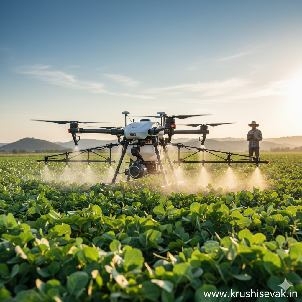
Drone sprayers, which feature large payload tanks and specialized ultra-low-volume (ULV) nozzles, offer an alternative. These autonomous drones fly just a few meters above the crop canopy. The downward draft generated by the drone’s rotors creates an air current that pushes the liquid downward, ensuring the chemical evenly coats both the top and underside of the leaves.
Using AI-generated prescription maps, spraying drones apply variable rates of inputs. They apply pesticides, fungicides, or liquid fertilizers only to the exact zones that require them, reducing chemical usage by up to 30% to 40% and saving up to 90% of the water typically required for traditional spraying methods. Additionally, advanced drones are now utilized for autonomous seed sowing, firing seed pods compressed with nutrients directly into the soil to assist in large-scale reforestation and cover-crop planting.
3. Real-Time Crop Health Monitoring
The early detection of anomalies is vital to preventing widespread crop failure. As a drone flies over a field, its multispectral sensors record data used to calculate various vegetative indices, the most common being the Normalized Difference Vegetation Index (NDVI).
Healthy, chlorophyll-rich vegetation absorbs most of the visible red light while reflecting a high proportion of near-infrared light. Conversely, stressed, diseased, or undernourished vegetation reflects more red light and less NIR light. By generating color-coded NDVI maps, drones allow farmers to spot visual anomalies indicative of fungal infections, nitrogen deficiencies, or insect attacks early, allowing for localized treatments before the issue spreads across the entire farm.
4. Irrigation Management and Drought Detection
Water scarcity is one of the most critical challenges facing modern global agriculture. Drones equipped with thermal sensors allow farmers to map the water dynamics of their fields. Areas showing elevated thermal signatures indicate crops that are under moisture stress due to insufficient watering or a broken irrigation pipe. Conversely, unusually cool or damp zones indicate waterlogging, which can rot plant roots and breed fungal pathogens. This real-time feedback loop enables farmers to optimize their drip or center-pivot irrigation systems, conserving water resources while maintaining optimal soil moisture conditions.
5. Livestock Monitoring and Pasture Management
Drones are not exclusively limited to crop cultivation; they have found a vital role in livestock management. Drones equipped with thermal imaging cameras can locate lost, stolen, or injured cattle across vast, rugged pastures, even at night. Advanced computer vision algorithms can count herd populations autonomously from above, saving hours of manual labor. Furthermore, thermal scanning can identify individual animals with elevated body temperatures, signaling illness or infection early enough for ranchers to quarantine the animal and prevent an outbreak within the herd.
Quantifiable Benefits: Efficiency, Yield, and Sustainability
The widespread adoption of drone technology is driven by its clear economic and environmental advantages.
Maximizing Crop Yields
By providing deep insight into plant health and field conditions, drones play a direct role in maximizing overall crop yield. Early detection of pests prevents devastating crop losses, while precise nutrient mapping ensures that plants receive optimal fertilization. According to various global agricultural studies, the integration of precision drone mapping and variable-rate applications can increase overall crop productivity by 10% to 15% depending on the crop variety and regional environment.
Operational and Economic Efficiency
Drones save farmers significant time and labor. Scouting a 500-acre farm on foot or via an all-terrain vehicle can take days, and subtle, early signs of disease are often missed. A drone can map that same acreage in under an hour, sending processed analytics directly to a smartphone. Furthermore, the massive reduction in the consumption of expensive chemical inputs, fertilizers, and water translates directly to lower operating costs and higher profit margins for farmers.
Driving Environmental Sustainability
The environmental benefits of agricultural drones are profound. By curbing the excessive use of synthetic fertilizers and pesticides, drones dramatically reduce chemical runoff into local rivers, lakes, and underground aquifers. Additionally, because battery-powered electric drones replace heavy, diesel-guzzling tractors for spraying operations, they significantly lower the overall carbon footprint of farm management, paving the way for sustainable, climate-smart agriculture.
Challenges and Limitations Affecting Adoption
Despite the immense advantages, the integration of drones into global agriculture is not without its challenges. Several hurdles continue to limit widespread adoption, particularly among smallholder farmers.
High Initial Capital Investment
The initial cost of purchasing commercial-grade agricultural drones, specialized multispectral sensors, and advanced data-processing software licenses can be quite high. For small-scale or family-owned farms with tight financial margins, this upfront investment can be a significant barrier to entry, though this is increasingly mitigated by the rise of specialized third-party “Drone-as-a-Service” (DaaS) providers.
Flight Time and Battery Limitations
Most commercial multi-rotor drones have a relatively short flight time, typically ranging between 20 to 40 minutes per battery charge, especially when carrying heavy liquid payloads. This necessitates maintaining multiple expensive lithium-polymer batteries and mobile charging setups out in the field. While fixed-wing drones offer significantly longer flight times, they cannot hover and are unsuitable for precise crop-spraying operations.
Regulatory and Airspace Restrictions
The operation of drones is subject to strict civil aviation regulations worldwide. Governments frequently impose rigid rules regarding pilot certifications, maximum flight altitudes, line-of-sight operations, and restricted airspace zones. Navigating complex bureaucratic channels to acquire commercial drone permits can slow down adoption, particularly in developing nations.
Technical Expertise and Data Management
Drones generate vast amounts of complex data that require sophisticated software to interpret. Farmers must either undergo intensive technical training to learn how to operate the flight systems and interpret vegetative index maps, or rely on agricultural consultants. Furthermore, in remote rural regions, limited high-speed internet connectivity can hinder the rapid uploading of large data files to cloud networks for analysis.
The Path Forward: Future Innovations
The next decade promises even greater advancements in agricultural drone capabilities. As battery technology improves, we will see the emergence of hybrid fuel-electric or solar-assisted drones capable of staying airborne for hours.
The integration of Drone Swarms is another rapidly approaching frontier. Instead of a single drone operating in isolation, a synchronized swarm of multiple autonomous drones will communicate with one another in real time. A single operator will be able to deploy a swarm where two drones map the field, three drones follow behind to spot-spray identified weeds, and another pair inspects irrigation channels—drastically cutting operational times.
Furthermore, the deeper integration of drones with the broader Internet of Things (IoT) ecosystem will redefine smart farming. Drones will autonomously communicate with ground-based soil moisture sensors, weather stations, and robotic tractors. For instance, when a stationary ground sensor detects a drop in soil moisture, it will automatically summon an autonomous drone to inspect the zone or trigger a smart irrigation pivot to activate.
Conclusion
Drone technology has transcended its origins to become a vital pillar of modern smart farming. By acting as an aerial data hub, UAVs provide farmers with unprecedented visibility, turning raw data into highly precise, actionable intelligence.
Though structural challenges like high initial costs, short battery life, and evolving regulatory frameworks remain, the undeniable benefits—ranging from optimized resource management and minimized environmental degradation to enhanced operational efficiency and increased crop yields—ensure that drones will continue to play a foundational role in the future of food production. As these technologies become more affordable, autonomous, and deeply integrated with artificial intelligence, drones will continue to empower farmers to produce more food with fewer resources, securing global food supplies for generations to come.